
The Seychelles National Meteorological Authority (SMA) deploys its second Marine Buoy Northwest of Mahe
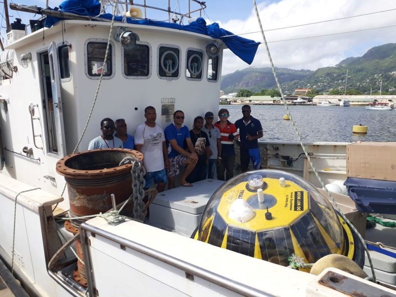
The Seychelles National Meteorological Authority in collaboration with local partners, Seychelles Fishing Authority (SFA) and Metocean Services International has deployed one directional wave buoy between Mahe and Silhouette Island. The deployment was carried out in May 2018 and an onshore receiving station installed for local display of data and such is being transmitted via radio to the receiving station for local display, and via GSM to a website for remote access. The objective is to measure real-time oceanographic parameters and collect data sets for research purposes. The information derived from the system is extremely important for a variety of marine and coastal activities and which in future can also support the blue economy concept in relation to fishing activities and offshore industries.
The type and model of the Wave Buoy is manufactured by “AXYS TECHNOLOGIES INC” and is economical, rugged, and can withstand the rigors associated with deployment and recovery operations, specifically: impact shock, spinning, and temporary submergence. It consists of integrated sensor systems and provides onboard data processing, data logging, telemetry, and diagnostic/set-up routines. The software performs a zero-crossing analysis to compute various time-domain wave parameters. The buoy is capable of accurate motion data for roll and pitch angles up to 60 degrees. Surge and sway velocities measure wave kinematics that defines directional wave properties.
Data transmitted from the buoy includes wave statistics, HNE (Heave, North and East Displacements), MeanDir (Wave Direction and energy as a function of frequency), directional and non-directional wave spectra, buoy configuration, status data, position and WatchCircle™ alarm messages. The equipment was received under a grant for the MESA (Monitoring for Environment and Security in Africa) project funded by European Union.